Johannesburg (Joburg Jozi) train map
You can find on this page the Johannesburg (Joburg Jozi) trains map to print and to download in PDF. The Johannesburg (Joburg Jozi) trains map presents the rail network and railway stations of the trains of Johannesburg (Joburg Jozi) in Gauteng - South Africa.
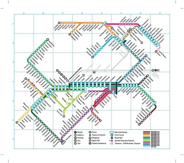
Johannesburg (Joburg Jozi) rail map
The Johannesburg (Joburg Jozi) rails map shows all the railway stations and lines of Johannesburg (Joburg Jozi) trains. This railway map of Johannesburg (Joburg Jozi) will allow you to easily plan your route with the trains of Johannesburg (Joburg Jozi) in Gauteng - South Africa. The Johannesburg (Joburg Jozi) rails map is downloadable in PDF, printable and free.
The Metrorail Gauteng commuter rail system connects central Johannesburg (Joburg Jozi) to Soweto, Pretoria, and most of the satellite towns along the Witwatersrand. The railways transport huge numbers of workers everyday. However, the Metrorail infrastructure was built in Johannesburg (Joburg Jozi) infancy and covers only the older areas in the city south. The northern areas as its shown in Johannesburg (Joburg Jozi) rail map, including the business districts of Sandton, Midrand, Randburg, and Rosebank, are served by the rapid rail link Gautrain.